[The Source Code] From satellites to high seas: How GPS is the surprising link between our work and Jake’s endurance race
Jake Still took on the challenge of rowing solo across the Atlantic Ocean to raise money for the rivers he loves back home. But how is the GPS technology he used to navigate linked to the work of The Rivers Trust? Part of [The Source Code] series: regular tech and data insights from The Rivers Trust’s Heather Bell, celebrating the digital tools and teams powering environmental change. Sign up to our newsletter to get every piece delivered to your inbox.
02/02/26
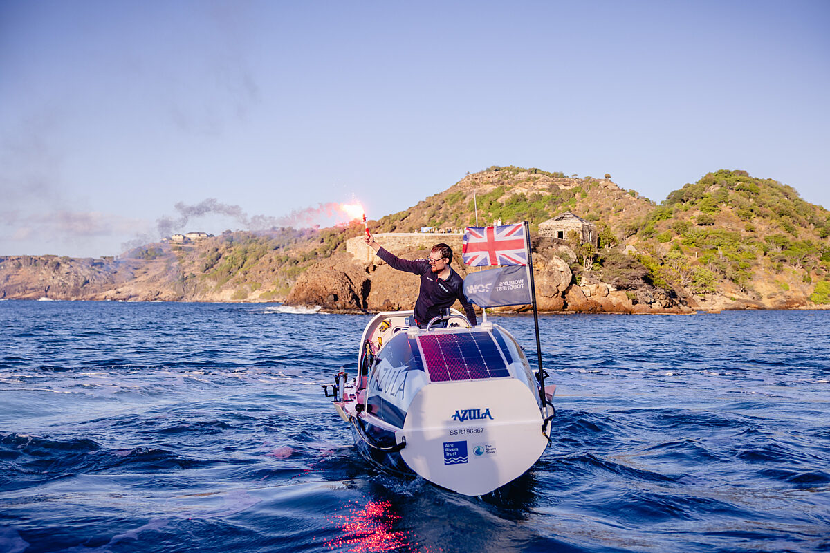
Jake Still has rowed 3000 miles across the Atlantic Ocean from La Gomera to Antigua to raise money for The Rivers Trust and Aire Rivers Trust. There are several technologies that were on board with Jake, communicating his location and tracking his route with the outside world. If you head to Jake’s Instagram account, where he has shared his epic journey, you will notice some clues on his boat. Aerials, receivers, and a waterproof yellow beacon (EPIRB: Emergency Position Indicating Radio Beacon). Some of these geospatial positioning systems may only be activated in the event of an emergency.
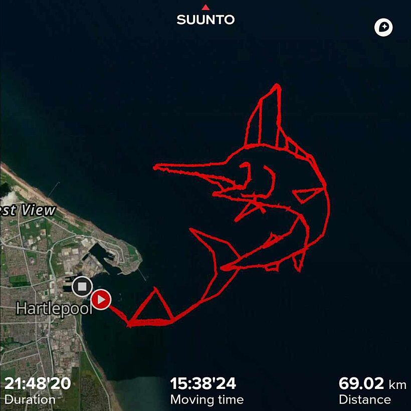
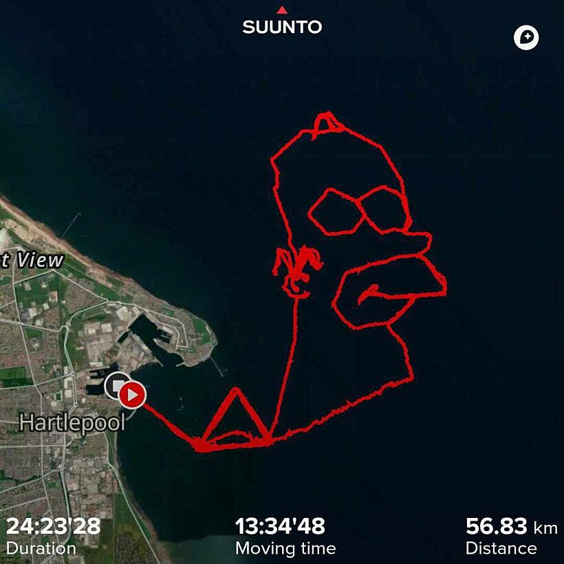
GPS is the Global Positioning System that many of us are familiar with. Most phones and smartwatches have a GPS chip that lets us track routes and create pretty maps of our park run, or other adventures. During his training rows, Jake took it a step further and used GPS data to create artwork, painting maps of whales and cartoon characters in the North Sea (see below).
But GPS is just one example of a Global Navigation Satellite System (GNSS), and many receivers switch between different systems for better coverage. GNSS receivers obtain a fix from signals transmitted by orbiting satellites. In the unlikely event of an emergency, the yellow beacon that Jake carried on board would alert search and rescue services via transmitting a coded message to the COSPAS-SARSAT satellite system.
We use GPS every day in The Rivers Trust Movement, locating and mapping nature-based solutions, or with drone surveys to record data into real-world coordinates in maps. You probably used GPS when you participated in the Big River Watch, surveying your local river’s health on our phone app.
Congratulations to Jake on his Atlantic row from the Technical Team at The Rivers Trust! You can still support Jake's fundraiser and help him raise money for river restoration.